Geolocate

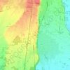
Cerano topographic map

Click on the map to display elevation.

About this map

Name: Cerano topographic map, elevation, terrain.

Location: Cerano, Novara, Piemonte, 28065, Italia (45.37438 8.73045 45.43537 8.84290)

Average elevation: 122 m

Minimum elevation: 93 m

Maximum elevation: 143 m

Other topographic maps

Click on a map to view its topography, its elevation and its terrain.

Coiromonte

Italia > Piemonte > Novara

Average elevation: 739 m

Fosseno

Italia > Piemonte > Novara

Average elevation: 548 m

Gaggiolo

Italia > Piemonte > Novara

Average elevation: 211 m

Tabarino

Italia > Piemonte > Novara

Average elevation: 555 m

Gear up for your next adventure:

🧢Outdoor Cap - Protective cap for sun and rain during hikes
🥾Trekking Poles - Adjustable trekking poles to reduce knee stress and improve stability
🧦Hiking Socks - Moisture-wicking and comfortable socks for long hikes
🚲Handlebar Phone Mount - View topographic-map.com live while cycling
🥾Mountain Hiking Boots - High-traction boots for rocky terrain

As an Amazon Associate, this site earns from qualifying purchases at no extra cost to you.