Geolocate

Celle topographic map

Click on the map to display elevation.

About this map

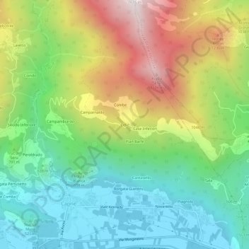
Name: Celle topographic map, elevation, terrain.

Location: Celle, Caprie, Torino, Piemonte, 10057, Italia (45.11151 7.32472 45.15151 7.36472)

Average elevation: 795 m

Minimum elevation: 352 m

Maximum elevation: 1,555 m

Gear up for your next adventure:

🔋Emergency Crank Radio - Weather alerts and power without needing batteries
🔭Compact Binoculars - Lightweight optics for scouting trails and wildlife
👖Convertible Hiking Pants - Zip-off legs to adapt to changing weather conditions
🥾Mountain Hiking Boots - High-traction boots for rocky terrain
👟Leg Gaiters - Keep debris, mud, and snow out of your boots

As an Amazon Associate, this site earns from qualifying purchases at no extra cost to you.