
River Ridge topographic map
Click on the map to display elevation.
About this map
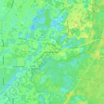
Name: River Ridge topographic map, elevation, terrain.
Location: River Ridge, Pasco County, Florida, 34654, United States (28.22971 -82.67191 28.30971 -82.59191)
Average elevation: 11 m
Minimum elevation: 2 m
Maximum elevation: 22 m
Other topographic maps
Click on a map to view its topography, its elevation and its terrain.
Zephyrhills
United States > Florida > Pasco County
Zephyrhills is known for its rolling topography, hence the name.
Average elevation: 32 m
San Antonio
United States > Florida > Pasco County
San Antonio has a rolling topography with elevations varying from a low of 110 feet on the western edge of the city to as high as 183 feet on a hill overlooking Lake Jovita on the eastern edge of town.
Average elevation: 44 m