Geolocate

Odessa topographic map

Click on the map to display elevation.

About this map

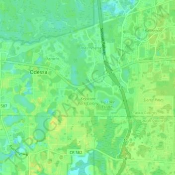
Name: Odessa topographic map, elevation, terrain.

Location: Odessa, Pasco County, Florida, United States (28.17270 -82.59252 28.19500 -82.51591)

Average elevation: 17 m

Minimum elevation: 9 m

Maximum elevation: 26 m

Gear up for your next adventure:

🦟Insect Repellent - Keep mosquitoes and black flies away in wooded areas
🚲MTB Frame Bag - Carry tools and maps directly on your bicycle frame
🥾Trail Hiking Shoes - Durable shoes designed for rugged trails
🧴First Aid Kit - Essential first aid supplies for outdoor emergencies
🧭GPS Tracker - Track your location in remote areas safely

As an Amazon Associate, this site earns from qualifying purchases at no extra cost to you.