Geolocate

Langsdale topographic map

Click on the map to display elevation.

About this map

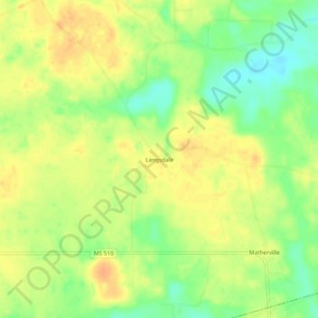
Name: Langsdale topographic map, elevation, terrain.

Location: Langsdale, Clarke County, Mississippi, United States (31.86904 -88.60448 31.90904 -88.56448)

Average elevation: 91 m

Minimum elevation: 71 m

Maximum elevation: 104 m

Gear up for your next adventure:

🧥Softshell Jacket - Windproof and breathable jacket for hiking
🧥Thermal Layer - Insulating layer for cold outdoor conditions
Camping Groundsheet - Protect your tent from moisture and dirt
🦟Insect Repellent - Keep mosquitoes and black flies away in wooded areas
Camping Tent - Weather-resistant tents suitable for 2 to 6 people

As an Amazon Associate, this site earns from qualifying purchases at no extra cost to you.