Geolocate

Zaña topographic map

Click on the map to display elevation.

About this map

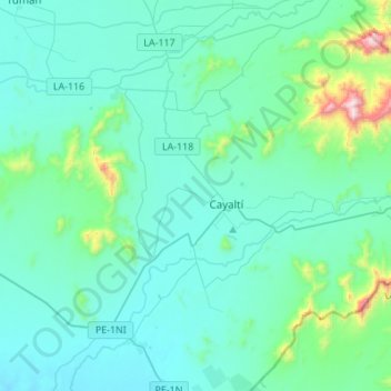
Name: Zaña topographic map, elevation, terrain.

Location: Zaña, Province of Chiclayo, Lambayeque, Peru (-6.99692 -79.77250 -6.77646 -79.49938)

Average elevation: 146 m

Minimum elevation: 14 m

Maximum elevation: 1,085 m

Gear up for your next adventure:

🥫Freeze-Dried Meals - Lightweight, high-calorie nutrition for multi-day treks
🧢Outdoor Visor - Breathable visor for sunny hikes
🧊Insulated Water Bottle - Keeps drinks cold in summer and prevents freezing in winter
🥾Waterproof Hiking Shoes - Durable shoes for wet and rugged trails
🛰️Satellite Messenger - Emergency communication for areas with no cell service

As an Amazon Associate, this site earns from qualifying purchases at no extra cost to you.