
Quibdó topographic map
Click on the map to display elevation.
Quibdó
Quibdó se encuentra situado sobre la margen derecha del río Atrato, uno de los principales afluentes del país y una de las zonas con más alta pluviosidad del mundo. Se encuentra a una altitud de 43 m s. n. m. y tiene una temperatura cuyo promedio es de 28 ℃. Dista de Bogotá 557 kilómetros (346 mi).
About this map
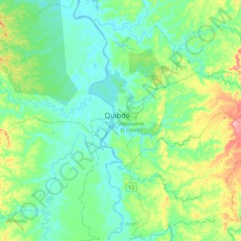
Name: Quibdó topographic map, elevation, terrain.
Location: Quibdó, Atrato, Chocó, Colombia (5.53234 -76.81838 5.85234 -76.49838)
Average elevation: 57 m
Minimum elevation: 18 m
Maximum elevation: 191 m