
Make a donation
Gear up for your next adventure:
As an Amazon Associate, this site earns from qualifying purchases at no extra cost to you.
Jolanda di Savoia topographic map
Click on the map to display elevation.
Make a donation
Gear up for your next adventure:
As an Amazon Associate, this site earns from qualifying purchases at no extra cost to you.
Jolanda di Savoia
With a minimum elevation of −3.4 metres (−11 ft), Joland di Savoia is the lowest point in Italy.
Make a donation
Gear up for your next adventure:
As an Amazon Associate, this site earns from qualifying purchases at no extra cost to you.
About this map
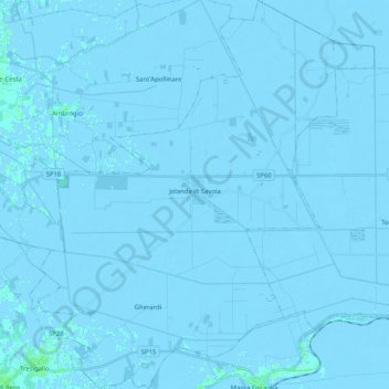
Name: Jolanda di Savoia topographic map, elevation, terrain.
Location: Jolanda di Savoia, Ferrara, Emilia-Romagna, 44037, Italy (44.80831 11.89148 44.95355 12.07415)
Average elevation: -2 m
Minimum elevation: -6 m
Maximum elevation: 5 m
Make a donation
Gear up for your next adventure:
As an Amazon Associate, this site earns from qualifying purchases at no extra cost to you.
Other topographic maps
Click on a map to view its topography, its elevation and its terrain.