Geolocate

Thiruporur topographic map

Click on the map to display elevation.

About this map

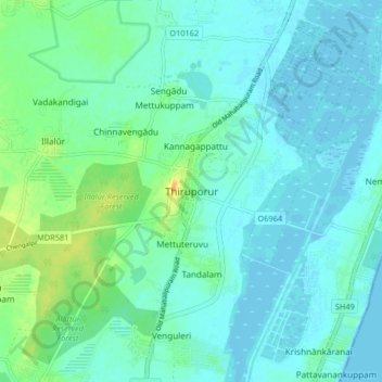
Name: Thiruporur topographic map, elevation, terrain.

Location: Thiruporur, Kanchipuram district, Tamil Nadu, India (12.68586 80.14952 12.76586 80.22952)

Average elevation: 7 m

Minimum elevation: -2 m

Maximum elevation: 34 m

Gear up for your next adventure:

🔋Lithium AA Batteries - Long-lasting power that performs in extreme cold
🥾Waterproof Hiking Boots - Boots keeping your feet dry in wet conditions
🛰️Satellite Messenger - Emergency communication for areas with no cell service
🪜Heavy Duty Carabiners - Multi-use clips for securing gear to your backpack
🚲MTB Frame Bag - Carry tools and maps directly on your bicycle frame

As an Amazon Associate, this site earns from qualifying purchases at no extra cost to you.