
Глубокский район topographic map
Interactive map
Click on the map to display elevation.
About this map
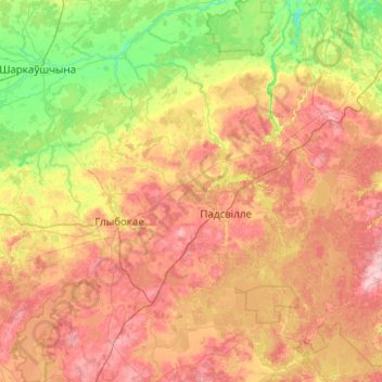
Name: Глубокский район topographic map, elevation, terrain.
Location: Глубокский район, Витебская область, Wit-Rusland (54.99756 27.36694 55.36922 28.36121)
Average elevation: 167 m
Minimum elevation: 116 m
Maximum elevation: 231 m
Other topographic maps
Click on a map to view its topography, its elevation and its terrain.
Иваново
Wit-Rusland > Витебская область > Германовичский сельский Совет
Иваново, Германовичский сельский Совет, Шарковщинский район, Витебская область, Wit-Rusland
Average elevation: 132 m