Geolocate

Passy topographic map

Click on the map to display elevation.

About this map

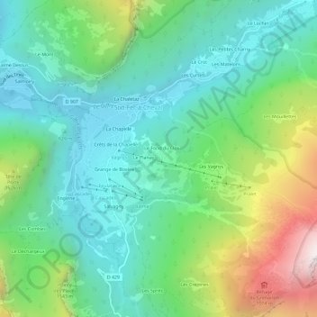
Name: Passy topographic map, elevation, terrain.

Location: Passy, Sixt-Fer-à-Cheval, Bonneville, Haute-Savoie, Auvergne-Rhône-Alpes, France métropolitaine, 74740, France (46.02822 6.75912 46.06822 6.79912)

Average elevation: 1,177 m

Minimum elevation: 733 m

Maximum elevation: 2,295 m

Other topographic maps

Click on a map to view its topography, its elevation and its terrain.

Gear up for your next adventure:

🧴Outdoor Sunscreen - High SPF protection for high-altitude UV exposure
🥾Light Trekking Boots - Supportive boots for multi-day treks
🔦UV Flashlight - Detect minerals or specific insects in the dark
Camping Essentials - All-in-one gear for a comfortable camping trip
🧦Outdoor Socks - Durable socks designed for hiking and outdoor sports

As an Amazon Associate, this site earns from qualifying purchases at no extra cost to you.