Geolocate

Valmalenco topographic map

Click on the map to display elevation.

About this map
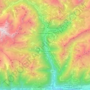
Name: Valmalenco topographic map, elevation, terrain.

Location: Valmalenco, Chiesa in Valmalenco, Comunità montana della Valtellina di Sondrio, Sondrio, Lombardia, 23023, Italia (46.17252 9.77011 46.31783 9.86718)

Average elevation: 1,786 m

Minimum elevation: 292 m

Maximum elevation: 3,623 m

Other topographic maps

Click on a map to view its topography, its elevation and its terrain.

Alpe Palù

Italia > Lombardia > Sondrio > Chiesa in Valmalenco

Average elevation: 1,682 m

Gear up for your next adventure:

🥾Mountain Trail Shoes - High-traction shoes for mountain trails
🧴First Aid Kit - Essential first aid supplies for outdoor emergencies
⛺Camping Groundsheet - Protect your tent from moisture and dirt
🛶Canoe Life Vest - Safety vest for water sports
🥾Trail Hiking Socks - Comfortable socks to prevent blisters and fatigue

As an Amazon Associate, this site earns from qualifying purchases at no extra cost to you.