Geolocate

Cruzyacu topographic map

Click on the map to display elevation.

About this map

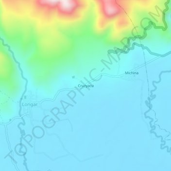
Name: Cruzyacu topographic map, elevation, terrain.

Location: Cruzyacu, Longar, Rodríguez de Mendoza, Amazonas, Perú (-6.40113 -77.55307 -6.36113 -77.51307)

Average elevation: 1,661 m

Minimum elevation: 1,557 m

Maximum elevation: 2,140 m

Gear up for your next adventure:

🥾Hiking Shoes - Durable and comfortable shoes for trail hiking
🥾Trail Running Shoes - Lightweight and durable shoes for trail running
Lightweight Backpacking Tent - Compact tent for efficient hiking trips
💡LED Camping Lantern - Illuminate your campsite with long-lasting lanterns
🎒Fully Waterproof Backpack - Total protection for photography gear and electronics

As an Amazon Associate, this site earns from qualifying purchases at no extra cost to you.