Geolocate

Alt Garge topographic map

Click on the map to display elevation.

About this map

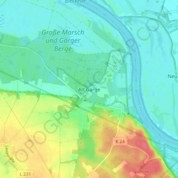
Name: Alt Garge topographic map, elevation, terrain.

Location: Alt Garge, Bleckede, Lüneburg, Lower Saxony, Germany (53.24893 10.77418 53.28893 10.81418)

Average elevation: 24 m

Minimum elevation: 5 m

Maximum elevation: 67 m

Gear up for your next adventure:

🥾All-Terrain Hiking Boots - Versatile boots for varied hiking conditions
🛶Kayak Dry Bag - Waterproof storage for kayaking adventures
🥾Waterproof Hiking Boots - Boots keeping your feet dry in wet conditions
🧥Thermal Layer - Insulating layer for cold outdoor conditions
🏃Hydration Running Vest - Carry water and maps close to your body for speed

As an Amazon Associate, this site earns from qualifying purchases at no extra cost to you.