
Make a donation
Gear up for your next adventure:
As an Amazon Associate, this site earns from qualifying purchases at no extra cost to you.
Pforzheimer Hütte topographic map
Click on the map to display elevation.
Make a donation
Gear up for your next adventure:
As an Amazon Associate, this site earns from qualifying purchases at no extra cost to you.
Pforzheimer Hütte
Die Pforzheimer Hütte, auch Adolf-Witzenmann-Haus, ist eine Alpenvereinshütte der Sektion Pforzheim des Deutschen Alpenvereins in 2308 m ü. A. Höhe im Gleirschtal in den Stubaier Alpen nahe der Ortschaft St. Sigmund im Sellrain.
Make a donation
Gear up for your next adventure:
As an Amazon Associate, this site earns from qualifying purchases at no extra cost to you.
About this map
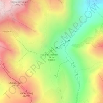
Name: Pforzheimer Hütte topographic map, elevation, terrain.
Average elevation: 2,474 m
Minimum elevation: 1,965 m
Maximum elevation: 3,004 m
Make a donation
Gear up for your next adventure:
As an Amazon Associate, this site earns from qualifying purchases at no extra cost to you.