
Thank you for supporting this site ❤️
Make a donation
Make a donation
Gear up for your next adventure:
As an Amazon Associate, this site earns from qualifying purchases at no extra cost to you.
Bisalhães topographic map
Click on the map to display elevation.
Thank you for supporting this site ❤️
Make a donation
Make a donation
Gear up for your next adventure:
As an Amazon Associate, this site earns from qualifying purchases at no extra cost to you.
About this map
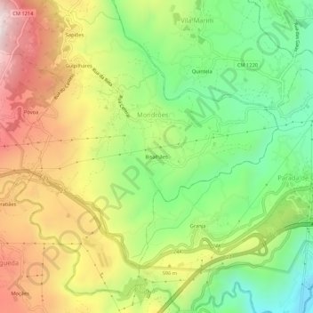
Name: Bisalhães topographic map, elevation, terrain.
Location: Bisalhães, Mondrões, Vila Real, 5000-745, Portugal (41.26737 -7.80729 41.30737 -7.76729)
Average elevation: 517 m
Minimum elevation: 198 m
Maximum elevation: 911 m
Thank you for supporting this site ❤️
Make a donation
Make a donation
Gear up for your next adventure:
As an Amazon Associate, this site earns from qualifying purchases at no extra cost to you.