
Obergurgl topographic map
Interactive map
Click on the map to display elevation.
About this map
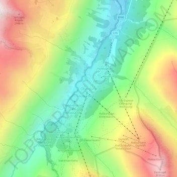
Name: Obergurgl topographic map, elevation, terrain.
Location: Obergurgl, Sölden, Bezirk Imst, Tyrol, 6456, Austria (46.85116 11.00825 46.89116 11.04825)
Average elevation: 2,322 m
Minimum elevation: 1,795 m
Maximum elevation: 3,083 m