
Thank you for supporting this site ❤️
Make a donation
Make a donation
Gear up for your next adventure:
As an Amazon Associate, this site earns from qualifying purchases at no extra cost to you.
Montagnano topographic map
Click on the map to display elevation.
Thank you for supporting this site ❤️
Make a donation
Make a donation
Gear up for your next adventure:
As an Amazon Associate, this site earns from qualifying purchases at no extra cost to you.
About this map
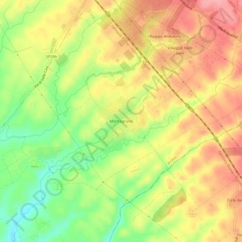
Name: Montagnano topographic map, elevation, terrain.
Location: Montagnano, Ardea, Roma Capitale, Lazio, 00040, Italia (41.64547 12.57812 41.68547 12.61812)
Average elevation: 100 m
Minimum elevation: 40 m
Maximum elevation: 149 m
Thank you for supporting this site ❤️
Make a donation
Make a donation
Gear up for your next adventure:
As an Amazon Associate, this site earns from qualifying purchases at no extra cost to you.