
Make a donation
Gear up for your next adventure:
As an Amazon Associate, this site earns from qualifying purchases at no extra cost to you.
El Kseur topographic map
Click on the map to display elevation.
Make a donation
Gear up for your next adventure:
As an Amazon Associate, this site earns from qualifying purchases at no extra cost to you.
El Kseur
The town of El Kseur enjoys a temperate and humid climate with a mild winter characteristic of the Mediterranean zones and an important rainfall, like all the towns of the eastern half of the Algerian coast. Due to the mountainous massifs surrounding the city, it snow every year in winter between December and February for high altitudes of over 600 m.
Make a donation
Gear up for your next adventure:
As an Amazon Associate, this site earns from qualifying purchases at no extra cost to you.
About this map
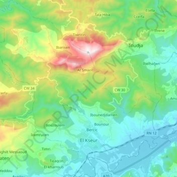
Name: El Kseur topographic map, elevation, terrain.
Location: El Kseur, El Kseur District, Bejaia, 06003, Algeria (36.64745 4.76309 36.78688 4.91725)
Average elevation: 342 m
Minimum elevation: 14 m
Maximum elevation: 1,298 m
Make a donation
Gear up for your next adventure:
As an Amazon Associate, this site earns from qualifying purchases at no extra cost to you.