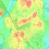
Concord River topographic map
Click on the map to display elevation.
Concord River
The river begins in Middlesex County, formed by the confluence of the Sudbury and Assabet Rivers at Egg Rock, near the Concord town center. It flows generally north, from eastern Concord (along the northwestern edge of the Boston metropolitan area), joining the Merrimack River from the south on the eastern side of Lowell. It is a gently flowing stream with little variation in topography along most of its route. Its drainage basin stretches into Worcester County and includes 36 towns within Massachusetts.
About this map

Name: Concord River topographic map, elevation, terrain.
Average elevation: 50 m
Minimum elevation: 15 m
Maximum elevation: 114 m
Other topographic maps
Click on a map to view its topography, its elevation and its terrain.