Geolocate

Fürten topographic map

Click on the map to display elevation.

About this map

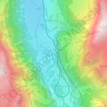
Name: Fürten topographic map, elevation, terrain.

Location: Fürten, Kandergrund, Frutigen-Niedersimmental administrative district, Oberland administrative region, Bern, 3716, Switzerland (46.51990 7.64815 46.55990 7.68815)

Average elevation: 1,402 m

Minimum elevation: 805 m

Maximum elevation: 2,346 m

Other topographic maps

Click on a map to view its topography, its elevation and its terrain.

Gear up for your next adventure:

🥾Waterproof Hiking Shoes - Durable shoes for wet and rugged trails
🛁Quick-Dry Microfiber Towel - Space-saving towel that dries rapidly on the move
🧦Hiking Liner Socks - Thin base layer to prevent friction and blisters
🔭Outdoor Binoculars - Lightweight binoculars for birdwatching and hiking
🪑Insulated Seat Pad - Protect your seat from cold rocks and wet logs

As an Amazon Associate, this site earns from qualifying purchases at no extra cost to you.