
Thank you for supporting this site ❤️
Make a donation
Make a donation
Gear up for your next adventure:
As an Amazon Associate, this site earns from qualifying purchases at no extra cost to you.
Tamesguida topographic map
Click on the map to display elevation.
Thank you for supporting this site ❤️
Make a donation
Make a donation
Gear up for your next adventure:
As an Amazon Associate, this site earns from qualifying purchases at no extra cost to you.
About this map
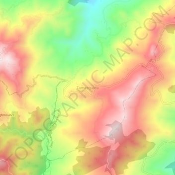
Name: Tamesguida topographic map, elevation, terrain.
Location: Tamesguida, Beni Haoua, Daïra Beni Haoua, Chlef, Algérie (36.42625 1.50843 36.46625 1.54843)
Average elevation: 585 m
Minimum elevation: 306 m
Maximum elevation: 806 m
Thank you for supporting this site ❤️
Make a donation
Make a donation
Gear up for your next adventure:
As an Amazon Associate, this site earns from qualifying purchases at no extra cost to you.