Geolocate

Javierre topographic map

Click on the map to display elevation.

About this map

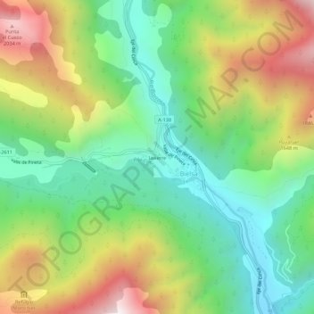
Name: Javierre topographic map, elevation, terrain.

Location: Javierre, Bielsa, Sobrarbe, Huesca, Aragón, 22350, España (42.61563 0.19342 42.65563 0.23342)

Average elevation: 1,400 m

Minimum elevation: 950 m

Maximum elevation: 2,114 m

Other topographic maps

Click on a map to view its topography, its elevation and its terrain.

Valle de Pineta

España > Aragón > Sobrarbe > Bielsa

Average elevation: 1,866 m

Gear up for your next adventure:

🚲MTB Frame Bag - Carry tools and maps directly on your bicycle frame
🛶Waterproof Dry Bags - Keep electronics and clothes dry during river crossings
🔋Lithium AA Batteries - Long-lasting power that performs in extreme cold
💡LED Headlamp - Hands-free illumination for night hiking and camping
🧥Packable Rain Jacket - Breathable waterproof layer for unpredictable weather

As an Amazon Associate, this site earns from qualifying purchases at no extra cost to you.