Geolocate

Autisha topographic map

Click on the map to display elevation.

About this map

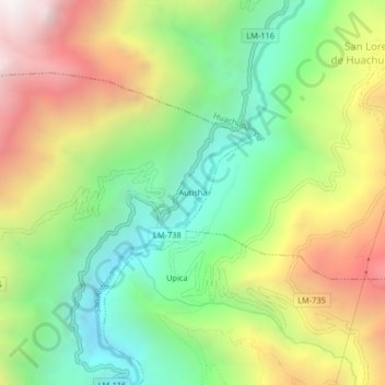
Name: Autisha topographic map, elevation, terrain.

Location: Autisha, San Antonio, Huarochirí, Lima, Perú (-11.75545 -76.62762 -11.71545 -76.58762)

Average elevation: 2,719 m

Minimum elevation: 1,974 m

Maximum elevation: 3,749 m

Other topographic maps

Click on a map to view its topography, its elevation and its terrain.

Plaza Central de Chacclla

Perú > Lima > San Antonio > Chaclla

Average elevation: 3,555 m

Gear up for your next adventure:

🧭Orienteering Kit - Tools for map reading and navigation in the wild
🧭GPS Handheld Device - Reliable GPS navigation for outdoor adventures
🧊Portable Cooler - Keep food and drinks cold during outdoor adventures
🏕️Camping Hammock - Integrated protection for sleeping between trees
🛶Canoe Life Vest - Safety vest for water sports

As an Amazon Associate, this site earns from qualifying purchases at no extra cost to you.