Geolocate

Roggan River topographic map

Click on the map to display elevation.

About this map

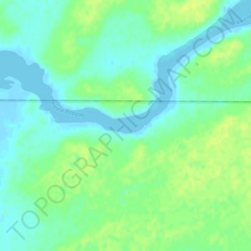
Name: Roggan River topographic map, elevation, terrain.

Location: Roggan River, Eeyou Istchee, Northern Quebec, Quebec, Canada (54.39612 -79.44455 54.41612 -79.42455)

Average elevation: 8 m

Minimum elevation: -5 m

Maximum elevation: 16 m

Eeyou Istchee trails, hiking, mountain biking, running and outdoor activities

Other topographic maps

Click on a map to view its topography, its elevation and its terrain.

Oujé-Bougoumou (Land)

Canada > Quebec > Eeyou Istchee

Average elevation: 372 m

Mistissini (Village)

Canada > Quebec > Eeyou Istchee

Average elevation: 415 m

Mistissini (Village)

Canada > Quebec > Eeyou Istchee

Average elevation: 415 m

Lac Margie

Canada > Quebec > Eeyou Istchee

Average elevation: 318 m

Waswanipi (Land)

Canada > Quebec > Eeyou Istchee

Average elevation: 314 m

Gear up for your next adventure:

🧦Hiking Socks - Moisture-wicking and comfortable socks for long hikes
🥾Waterproof Trail Shoes - Shoes designed to handle wet terrain
🧴Sunscreen SPF - Broad-spectrum sunscreen for outdoor activities
🛶Kayak Accessories - Essential gear for safe and fun kayaking adventures
🧊Portable Cooler - Keep food and drinks cold during outdoor adventures

As an Amazon Associate, this site earns from qualifying purchases at no extra cost to you.