
Thank you for supporting this site ❤️
Make a donation
Make a donation
Gear up for your next adventure:
As an Amazon Associate, this site earns from qualifying purchases at no extra cost to you.
Sacorelhe topographic map
Click on the map to display elevation.
Thank you for supporting this site ❤️
Make a donation
Make a donation
Gear up for your next adventure:
As an Amazon Associate, this site earns from qualifying purchases at no extra cost to you.
About this map
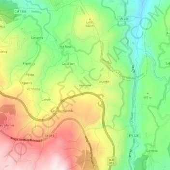
Name: Sacorelhe topographic map, elevation, terrain.
Location: Sacorelhe, Ventosa, Vouzela, Viseu, 3670-231, Portugal (40.67741 -8.10452 40.71741 -8.06452)
Average elevation: 532 m
Minimum elevation: 233 m
Maximum elevation: 903 m
Thank you for supporting this site ❤️
Make a donation
Make a donation
Gear up for your next adventure:
As an Amazon Associate, this site earns from qualifying purchases at no extra cost to you.