Geolocate

Provazzano topographic map

Click on the map to display elevation.

About this map
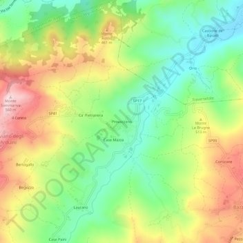
Name: Provazzano topographic map, elevation, terrain.

Location: Provazzano, Neviano degli Arduini, Parma, Emilia-Romagna, 43024, Italia (44.56522 10.32191 44.60522 10.36191)

Average elevation: 359 m

Minimum elevation: 208 m

Maximum elevation: 566 m

Other topographic maps

Click on a map to view its topography, its elevation and its terrain.

Gear up for your next adventure:

🧢Outdoor Cap - Protective cap for sun and rain during hikes
🥫Freeze-Dried Meals - Lightweight, high-calorie nutrition for multi-day treks
🔦LED Flashlight - Powerful and long-lasting flashlight for camping and emergencies
🥾Trekking Poles - Adjustable trekking poles to reduce knee stress and improve stability
📷Outdoor Action Camera - Capture high-elevation views and rugged adventures

As an Amazon Associate, this site earns from qualifying purchases at no extra cost to you.