Geolocate

Vasca Anti Incendio topographic map

Click on the map to display elevation.

About this map

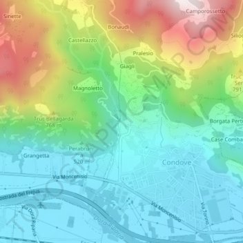
Name: Vasca Anti Incendio topographic map, elevation, terrain.

Location: Vasca Anti Incendio, Giagli, Condove, Torino, Piemonte, Italia (45.12185 7.30069 45.12200 7.30081)

Average elevation: 582 m

Minimum elevation: 365 m

Maximum elevation: 1,090 m

Gear up for your next adventure:

🔋Solar Power Bank - Keep your GPS and devices charged during long outdoor trips
🛏️Sleeping Bag - Warm and compact sleeping bags for outdoor camping
💡LED Headlamp - Hands-free illumination for night hiking and camping
Lightweight Camping Tent - Portable shelter optimized for Canadian backcountry camping
🎒Fully Waterproof Backpack - Total protection for photography gear and electronics

As an Amazon Associate, this site earns from qualifying purchases at no extra cost to you.