Geolocate

Santa Maria topographic map

Click on the map to display elevation.

About this map

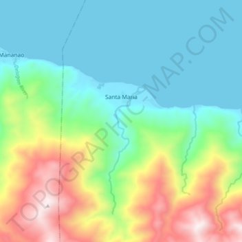
Name: Santa Maria topographic map, elevation, terrain.

Location: Santa Maria, Abra de Ilog, Occidental Mindoro, Mimaropa, Philippines (13.46652 120.58175 13.50182 120.66089)

Average elevation: 282 m

Minimum elevation: 0 m

Maximum elevation: 940 m

Other topographic maps

Click on a map to view its topography, its elevation and its terrain.

Gear up for your next adventure:

🧭Orienteering Kit - Tools for map reading and navigation in the wild
🧢Sun Protection Cap - Breathable cap to protect from sun exposure
🧳Compression Sacks - Maximize space in your backpack by shrinking gear
🧥Thermal Layer - Insulating layer for cold outdoor conditions
🥾Mountaineering Boots - Supportive boots for climbing and high-altitude hiking

As an Amazon Associate, this site earns from qualifying purchases at no extra cost to you.