Geolocate

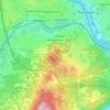
Lac Magog topographic map

Click on the map to display elevation.

About this map

Name: Lac Magog topographic map, elevation, terrain.

Location: Lac Magog, Rue du Trianon, Rock Forest–Saint-Élie–Deauville, Sherbrooke, Estrie, Québec, J1X 2W5, Canada (45.30339 -72.04036 45.30349 -72.04026)

Average elevation: 209 m

Minimum elevation: 189 m

Maximum elevation: 274 m

Other topographic maps

Click on a map to view its topography, its elevation and its terrain.

Parc Victoria

Canada > Québec > Sherbrooke

Average elevation: 196 m

Jacques-Cartier

Canada > Québec > Sherbrooke

Average elevation: 204 m

Lennoxville

Canada > Québec > Sherbrooke

Average elevation: 212 m

Parc de Notre-Dame-du-Laus

Canada > Québec > Sherbrooke

Average elevation: 216 m

Parc du Bois-Beckett

Canada > Québec > Sherbrooke

Average elevation: 214 m

Parc Victoria

Canada > Québec > Sherbrooke

Average elevation: 196 m

Le Mont-Bellevue

Canada > Québec > Sherbrooke

Average elevation: 239 m

Gear up for your next adventure:

🚑Survival Whistle - Signal for help across long distances in mountains
🧥Thermal Layer - Insulating layer for cold outdoor conditions
⛺Lightweight Backpacking Tent - Compact tent for efficient hiking trips
🧥Waterproof Jacket - Lightweight rain jackets for hiking and outdoor activities
☕Camping Coffee Maker - Brew fresh coffee anywhere on the topographic map

As an Amazon Associate, this site earns from qualifying purchases at no extra cost to you.