Geolocate

White Hall topographic map

Click on the map to display elevation.

About this map

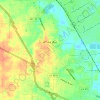
Name: White Hall topographic map, elevation, terrain.

Location: White Hall, Jefferson County, Arkansas, 71602, United States (34.24013 -92.12189 34.30103 -92.06186)

Average elevation: 81 m

Minimum elevation: 62 m

Maximum elevation: 103 m

Other topographic maps

Click on a map to view its topography, its elevation and its terrain.

Moscow

United States > Arkansas > Jefferson County

Average elevation: 58 m

Gear up for your next adventure:

🥾Waterproof Hiking Boots - Boots keeping your feet dry in wet conditions
💡Compact LED Flashlight - Powerful and portable flashlight for outdoor use
💧Reusable Water Bottle - Durable water bottles for hydration on trails
🧴Outdoor Sunscreen - High SPF protection for high-altitude UV exposure
🚑Survival Whistle - Signal for help across long distances in mountains

As an Amazon Associate, this site earns from qualifying purchases at no extra cost to you.