Geolocate

Roccastrada topographic map

Click on the map to display elevation.

About this map

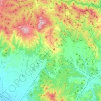
Name: Roccastrada topographic map, elevation, terrain.

Location: Roccastrada, Grosseto, Tuscany, Italy (42.89356 11.01105 43.09220 11.27084)

Average elevation: 245 m

Minimum elevation: 12 m

Maximum elevation: 783 m

Other topographic maps

Click on a map to view its topography, its elevation and its terrain.

Saturnia

Italy > Tuscany > Grosseto

Average elevation: 182 m

Gear up for your next adventure:

Family Camping Tent - Spacious tent suitable for family camping trips
🦟Insect Repellent - Keep mosquitoes and black flies away in wooded areas
🧊Portable Cooler - Keep food and drinks cold during outdoor adventures
🧥Thermal Layer - Insulating layer for cold outdoor conditions
🧰Emergency Multi-Tool - Compact multi-tool for outdoor survival

As an Amazon Associate, this site earns from qualifying purchases at no extra cost to you.