Geolocate

Harahan topographic map

Click on the map to display elevation.

About this map

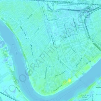
Name: Harahan topographic map, elevation, terrain.

Location: Harahan, Jefferson Parish, Louisiana, United States (29.92312 -90.21904 29.97377 -90.18416)

Average elevation: 3 m

Minimum elevation: -6 m

Maximum elevation: 19 m

Other topographic maps

Click on a map to view its topography, its elevation and its terrain.

Metairie

United States > Louisiana > Jefferson Parish

Average elevation: 2 m

Gear up for your next adventure:

🧦Outdoor Socks - Durable socks designed for hiking and outdoor sports
💡LED Headlamp - Hands-free illumination for night hiking and camping
🧥Softshell Hiking Jacket - The perfect balance of wind protection and breathability
🔦LED Headlamp - Hands-free lighting for early morning starts or late finishes
🦶Hiking Shoe Insoles - Added support for high arches and long days on feet

As an Amazon Associate, this site earns from qualifying purchases at no extra cost to you.