
Candelaria topographic map
Interactive map
Click on the map to display elevation.
About this map
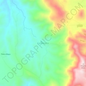
Name: Candelaria topographic map, elevation, terrain.
Location: Candelaria, Potosí, Provincia Tomás Frías, Potosí, Bolivie (-19.40279 -65.68559 -19.36279 -65.64559)
Average elevation: 3,976 m
Minimum elevation: 3,752 m
Maximum elevation: 4,394 m