Geolocate

Bigbiga topographic map

Click on the map to display elevation.

About this map

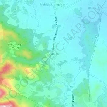
Name: Bigbiga topographic map, elevation, terrain.

Location: Bigbiga, Mayantoc, Tarlac, Central Luzon, 2304, Philippines (15.50966 120.35648 15.54966 120.39648)

Average elevation: 138 m

Minimum elevation: 74 m

Maximum elevation: 421 m

Other topographic maps

Click on a map to view its topography, its elevation and its terrain.

Mamonit

Philippines > Tarlac > Mayantoc

Average elevation: 71 m

Gear up for your next adventure:

🛶Kayak Dry Bag - Waterproof storage for kayaking adventures
👖Convertible Hiking Pants - Zip-off legs to adapt to changing weather conditions
🛌Insulated Sleeping Pad - Critical thermal barrier between you and the cold ground
🔦LED Headtorch - Bright and durable light for night activities
🔦LED Flashlight - Powerful and long-lasting flashlight for camping and emergencies

As an Amazon Associate, this site earns from qualifying purchases at no extra cost to you.