
Make a donation
Gear up for your next adventure:
As an Amazon Associate, this site earns from qualifying purchases at no extra cost to you.
Montafon topographic map
Click on the map to display elevation.
Make a donation
Gear up for your next adventure:
As an Amazon Associate, this site earns from qualifying purchases at no extra cost to you.
Montafon
Tourism plays a vital role and the Montafon is well-known for its skiing, hiking, and mountain biking. The Silvretta high alpine road (German: Hochalpenstraße) gives access to remote ski areas that are located altitudes of 650 to 1,430 meters. The construction of the Montafon Railway in 1905 also helped develop the seasonal tourist industries.
Make a donation
Gear up for your next adventure:
As an Amazon Associate, this site earns from qualifying purchases at no extra cost to you.
About this map
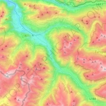
Name: Montafon topographic map, elevation, terrain.
Average elevation: 1,566 m
Minimum elevation: 577 m
Maximum elevation: 2,788 m
Make a donation
Gear up for your next adventure:
As an Amazon Associate, this site earns from qualifying purchases at no extra cost to you.