Geolocate

Les Karellis topographic map

Click on the map to display elevation.

About this map
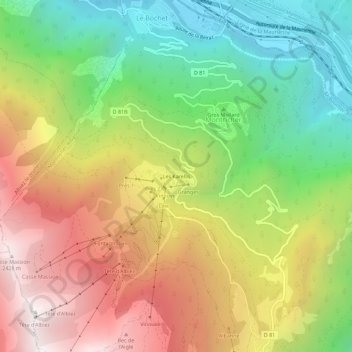
Name: Les Karellis topographic map, elevation, terrain.

Location: Les Karellis, Montricher-le-Bochet, Montricher-Albanne, Saint-Jean-de-Maurienne, Savoie, Auvergne-Rhône-Alpes, France métropolitaine, 73870, France (45.20857 6.38646 45.24857 6.42646)

Average elevation: 1,463 m

Minimum elevation: 612 m

Maximum elevation: 2,462 m

Other topographic maps

Click on a map to view its topography, its elevation and its terrain.

Albanne

France > Auvergne-Rhône-Alpes > Savoie > Montricher-Albanne

Average elevation: 1,730 m

Gear up for your next adventure:

🚲Handlebar Phone Mount - View topographic-map.com live while cycling
🏃Hydration Running Vest - Carry water and maps close to your body for speed
🧴Insect Repellent - Protect yourself from bugs during outdoor adventures
🕯️Camping Lantern - Illuminates your entire campsite with high-efficiency LEDs
🦯Trekking Poles - Reduced impact on joints for steep topographic climbs

As an Amazon Associate, this site earns from qualifying purchases at no extra cost to you.