Geolocate

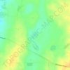
Coobowie topographic map

Click on the map to display elevation.

About this map

Name: Coobowie topographic map, elevation, terrain.

Location: Coobowie, Yorke Peninsula Council, South Australia, 5583, Australia (-35.07096 137.68748 -35.01315 137.76650)

Average elevation: 12 m

Minimum elevation: -1 m

Maximum elevation: 34 m

Other topographic maps

Click on a map to view its topography, its elevation and its terrain.
Gear up for your next adventure:

🛌Insulated Sleeping Pad - Critical thermal barrier between you and the cold ground
☕Camping Coffee Maker - Brew fresh coffee anywhere on the topographic map
⛺Family Camping Tent - Spacious tent suitable for family camping trips
🪜Heavy Duty Carabiners - Multi-use clips for securing gear to your backpack
🥾Approach Boots - Comfortable boots for hiking and climbing approaches

As an Amazon Associate, this site earns from qualifying purchases at no extra cost to you.