Geolocate

Bagori topographic map

Click on the map to display elevation.

About this map

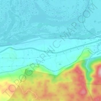
Name: Bagori topographic map, elevation, terrain.

Location: Bagori, Kaliabor, Nagaon, Assam, India (26.55778 93.25884 26.59778 93.29884)

Average elevation: 119 m

Minimum elevation: 64 m

Maximum elevation: 293 m

Gear up for your next adventure:

🧥Softshell Jacket - Windproof and breathable jacket for hiking
🥾Mountain Hiking Shoes - Shoes with superior grip for mountainous terrain
🧢Outdoor Cap - Protective cap for sun and rain during hikes
🦯Trekking Poles - Reduced impact on joints for steep topographic climbs
🥾Approach Boots - Comfortable boots for hiking and climbing approaches

As an Amazon Associate, this site earns from qualifying purchases at no extra cost to you.