
Thank you for supporting this site ❤️
Make a donation
Make a donation
Gear up for your next adventure:
As an Amazon Associate, this site earns from qualifying purchases at no extra cost to you.
Drôme topographic map
Click on the map to display elevation.
Thank you for supporting this site ❤️
Make a donation
Make a donation
Gear up for your next adventure:
As an Amazon Associate, this site earns from qualifying purchases at no extra cost to you.
About this map
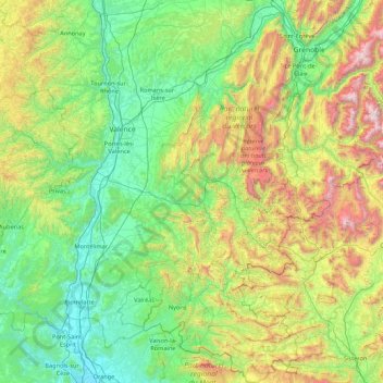
Name: Drôme topographic map, elevation, terrain.
Location: Drôme, Auvergne-Rhône-Alpes, Metropolitan France, France (44.11518 4.64691 45.34398 5.83035)
Average elevation: 683 m
Minimum elevation: 29 m
Maximum elevation: 2,979 m
Thank you for supporting this site ❤️
Make a donation
Make a donation
Gear up for your next adventure:
As an Amazon Associate, this site earns from qualifying purchases at no extra cost to you.