Geolocate

Baras topographic map

Click on the map to display elevation.

About this map

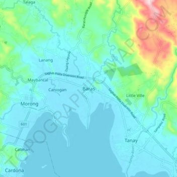
Name: Baras topographic map, elevation, terrain.

Location: Baras, Rizal, Calabarzon, 1970, Philippines (14.48185 121.22581 14.56185 121.30581)

Average elevation: 46 m

Minimum elevation: 0 m

Maximum elevation: 269 m

Other topographic maps

Click on a map to view its topography, its elevation and its terrain.

Cainta

Philippines > Rizal

Average elevation: 33 m

Gear up for your next adventure:

Tent Footprint - Protect tent floor and increase durability
🧭GPS Outdoor Watch - Smart watch for navigation and fitness tracking in nature
👟Leg Gaiters - Keep debris, mud, and snow out of your boots
🥾Hiking Shorts - Breathable shorts suitable for summer hikes
💡Solar Camping Lamp - Eco-friendly lighting for campsites

As an Amazon Associate, this site earns from qualifying purchases at no extra cost to you.