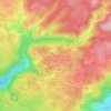
Miellin topographic map
Click on the map to display elevation.
Miellin
La meilleure façon de découvrir Miellin et son patrimoine est la randonnée. Deux sentiers sont balisés au départ de l'église. L'un permet notamment de découvrir l'ancienne verrerie, tandis que l'autre mène à la chapelle Saint-Blaise à 900 mètres d'altitude. Ces deux sentiers passent près des anciennes carrières.
About this map

Name: Miellin topographic map, elevation, terrain.
Average elevation: 758 m
Minimum elevation: 416 m
Maximum elevation: 1,118 m
Other topographic maps
Click on a map to view its topography, its elevation and its terrain.
Pré Boichey
France > Bourgogne-Franche-Comté > Haute-Saône > Servance-Miellin
Average elevation: 563 m
Le Voirmet
France > Bourgogne-Franche-Comté > Haute-Saône > Servance-Miellin > Miellin
Average elevation: 796 m
Le Grilloux
France > Bourgogne-Franche-Comté > Haute-Saône > Servance-Miellin > Le Grilloux
Average elevation: 587 m
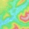
Servance
France > Bourgogne-Franche-Comté > Haute-Saône > Servance-Miellin > Servance
Average elevation: 527 m
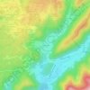
Les Évaudois
France > Bourgogne-Franche-Comté > Haute-Saône > Servance-Miellin > Les Évaudois
Average elevation: 549 m
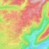
L'Enclose du Monthury
France > Bourgogne-Franche-Comté > Haute-Saône > Servance-Miellin
Average elevation: 576 m

Magny Maubert
France > Bourgogne-Franche-Comté > Haute-Saône > Servance-Miellin
Average elevation: 577 m

Les Breuchots
France > Bourgogne-Franche-Comté > Haute-Saône > Servance-Miellin
Average elevation: 564 m