Geolocate

Hebri topographic map

Click on the map to display elevation.

About this map

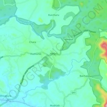
Name: Hebri topographic map, elevation, terrain.

Location: Hebri, Hebri taluku, Udupi, Karnataka, 576112, India (13.41943 74.95155 13.49943 75.03155)

Average elevation: 67 m

Minimum elevation: 23 m

Maximum elevation: 287 m

Gear up for your next adventure:

🔭Compact Monocular - One-handed bird watching and trail spotting
🧦Hiking Liner Socks - Thin base layer to prevent friction and blisters
🌬️Windproof Camp Stove - Efficient cooking even on exposed mountain peaks
🥫Freeze-Dried Meals - Lightweight, high-calorie nutrition for multi-day treks
🥾Light Trekking Boots - Supportive boots for multi-day treks

As an Amazon Associate, this site earns from qualifying purchases at no extra cost to you.