
Montelupo Fiorentino topographic map
Interactive map
Click on the map to display elevation.
About this map
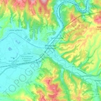
Name: Montelupo Fiorentino topographic map, elevation, terrain.
Average elevation: 95 m
Minimum elevation: 14 m
Maximum elevation: 272 m
Other topographic maps
Click on a map to view its topography, its elevation and its terrain.
Gambassi
Italy > Tuscany > Metropolitan City of Florence > Reggello
Gambassi, Reggello, Metropolitan City of Florence, Tuscany, 50064, Italy
Average elevation: 175 m