
Targovichte topographic map
Interactive map
Click on the map to display elevation.
About this map
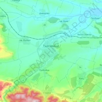
Name: Targovichte topographic map, elevation, terrain.
Average elevation: 237 m
Minimum elevation: 133 m
Maximum elevation: 668 m
Other topographic maps
Click on a map to view its topography, its elevation and its terrain.
Targovichte
Bulgarie > Oblast de Targovichte > Targovichte
Targovichte, Municipalité de Targovichte, Oblast de Targovichte, 7700, Bulgarie
Average elevation: 314 m