Geolocate

Panjoh topographic map

Click on the map to display elevation.

About this map

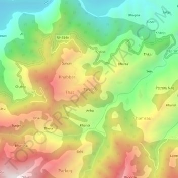
Name: Panjoh topographic map, elevation, terrain.

Location: Panjoh, That, Chamba, Himachal Pradesh, India (32.56848 76.02959 32.60848 76.06959)

Average elevation: 1,289 m

Minimum elevation: 683 m

Maximum elevation: 2,007 m

Gear up for your next adventure:

🔪Outdoor Multitool - Versatile tool for repairs and food prep in the wild
🛁Quick-Dry Microfiber Towel - Space-saving towel that dries rapidly on the move
🩹Moleskin Blister Pads - Direct protection for painful foot pressure points
👟Leg Gaiters - Keep debris, mud, and snow out of your boots
🛏️Camping Sleeping Mat - Comfortable mats for sleeping outdoors

As an Amazon Associate, this site earns from qualifying purchases at no extra cost to you.