Geolocate

Orchid Island topographic map

Click on the map to display elevation.

About this map
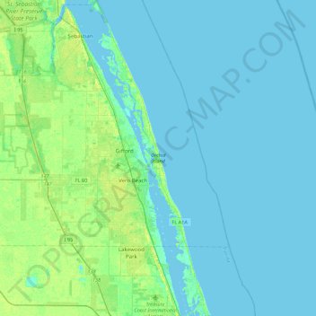
Name: Orchid Island topographic map, elevation, terrain.

Location: Orchid Island, Vero Beach, Indian River County, Florida, United States (27.47211 -80.45626 27.86022 -80.28923)

Average elevation: 4 m

Minimum elevation: -3 m

Maximum elevation: 17 m

Other topographic maps

Click on a map to view its topography, its elevation and its terrain.

Gear up for your next adventure:

🔦UV Flashlight - Detect minerals or specific insects in the dark
🥾Hiking Shoes - Durable and comfortable shoes for trail hiking
💧Reusable Water Bottle - Durable water bottles for hydration on trails
⛺Bushcraft Tarp - Versatile emergency shelter or gear protection
🏃Hydration Running Vest - Carry water and maps close to your body for speed

As an Amazon Associate, this site earns from qualifying purchases at no extra cost to you.