Geolocate

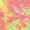
Le Doulay topographic map

Click on the map to display elevation.

About this map

Name: Le Doulay topographic map, elevation, terrain.

Location: Le Doulay, Saint-Étienne-de-Lugdarès, Largentière, Ardèche, Auvergne-Rhône-Alpes, France métropolitaine, 07590, France (44.64606 3.92412 44.68606 3.96412)

Average elevation: 1,124 m

Minimum elevation: 977 m

Maximum elevation: 1,351 m

Other topographic maps

Click on a map to view its topography, its elevation and its terrain.
Gear up for your next adventure:

🧳Compression Sacks - Maximize space in your backpack by shrinking gear
💡Portable Camping Lamp - Rechargeable lamp for campsite lighting
🧢Sun Hat - Wide-brim hat for sun protection
🦌Outdoor Trail Camera - Monitor wildlife activity near your favorite spots
🧰Emergency Multi-Tool - Compact multi-tool for outdoor survival

As an Amazon Associate, this site earns from qualifying purchases at no extra cost to you.