Geolocate

Gerald topographic map

Click on the map to display elevation.

About this map

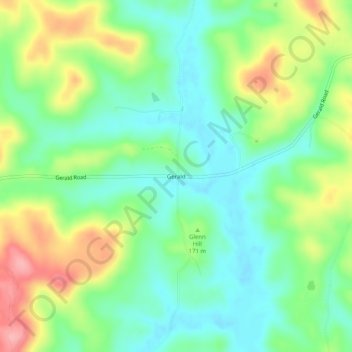
Name: Gerald topographic map, elevation, terrain.

Location: Gerald, Perry County, Indiana, 47525, United States (37.98756 -86.59304 38.02756 -86.55304)

Average elevation: 160 m

Minimum elevation: 118 m

Maximum elevation: 235 m

Other topographic maps

Click on a map to view its topography, its elevation and its terrain.

Cannelton

United States > Indiana > Perry County

Average elevation: 139 m

Troy

United States > Indiana > Perry County

Average elevation: 126 m

Gear up for your next adventure:

🧥Softshell Jacket - Windproof and breathable jacket for hiking
🔨Vehicle Emergency Tool - Safety tool for remote road trips to trailheads
💧Hydration Pack - Hands-free hydration system for long hikes
🥾Mountain Trail Shoes - High-traction shoes for mountain trails
🎒Hiking Backpack - Lightweight and ergonomic backpacks for day hikes or multi-day treks

As an Amazon Associate, this site earns from qualifying purchases at no extra cost to you.