Geolocate

Santa Rita topographic map

Click on the map to display elevation.

About this map

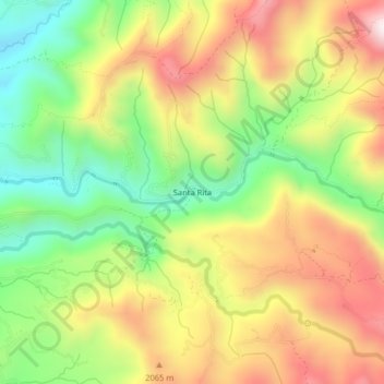
Name: Santa Rita topographic map, elevation, terrain.

Location: Santa Rita, Santa Rosa de Cabal, Risaralda, Colombia (4.87460 -75.59233 4.91460 -75.55233)

Average elevation: 1,912 m

Minimum elevation: 1,590 m

Maximum elevation: 2,267 m

Gear up for your next adventure:

Bushcraft Tarp - Versatile emergency shelter or gear protection
🧥Waterproof Pants - Keep dry during rainy hiking conditions
🔥Emergency Fire Starter - Reliable ignition source for all weather conditions
🧊Portable Cooler - Keep food and drinks cold during outdoor adventures
Camping Essentials - All-in-one gear for a comfortable camping trip

As an Amazon Associate, this site earns from qualifying purchases at no extra cost to you.